Greenway Whitewater (WA)
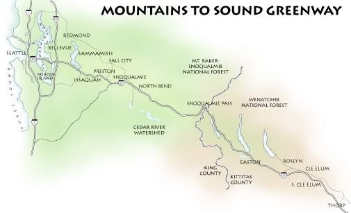
The Mountains to Sound Greenway stretches over 100 miles along Interstate 90 from the shores of Puget Sound in Seattle, over Snoqualmie Pass and into Central Washington. Much of the Greenway is public land and includes over 700,000 acres held by local, state and federal agencies in trust for the public good. The Greenway includes whitewater resources of national significance just outside the Seattle metropolitan area. American Whitewater is a partner with the Greenway in developing a longterm vision for the protection and stewardship of these whitewater rivers, many of which have been determined by the Forest Service to be eligible for Wild and Scenic designation.
American Whitewater served in a leadership capacity to designate the Mountains to Sound Greenway as a National Heritage Area in 2019 (Public Law 116-9).
The contacts below include staff and volunteers working on this project. Make sure you are logged in if you wish to join the group.
| Title | Name | City | |
|---|---|---|---|
| Thomas O'Keefe | Seattle WA | Details... | |
| Jennie Goldberg | Seattle WA | Details... |
Documents
Middle Fork of the Snoqualmie River Access Final Concept Plan (8/31/2005)
Concept plan identifying river access issues, needs, and recommendations for improvements to ensure the public has dedicated access to the Middle Fork of the Snoqualmie River in Washington.
Whitewater Paddling in the North Cascades [web version] (12/6/2008)
American Whitewater's survey of 165 whitewater enthusiasts on whitewater rivers of the North Cascades.
Whitewater Paddling in the North Cascades [print version] (12/6/2008)
American Whitewater's survey of 165 whitewater enthusiasts on whitewater rivers of the North Cascades.
Recreational Use of King County's River System (5/3/2010)
The purpose of this report is to improve the level of knowledge regarding the location, type and seasonality of river recreation in the major rivers within King County.
River Corridor Public Use Concept Phase II: Middle Fork of the Snoqualmie (12/31/1997)
Interagency plan for facility development and management along the Middle Fork of the Snoqualmie River.
Middle Fork of the Snoqualmie River Interpretive Plan (3/31/2004)
A preliminary document to guide development of interpretive facilities in the Middle Fork Snoqualmie Valley, while also informing the conceptual design work of park facilities along the river.

